ChicagoWachstum einer Metropole |
 |
| taken from: Chicago Growth 1850-1990: Maps by Dennis McClendon | |
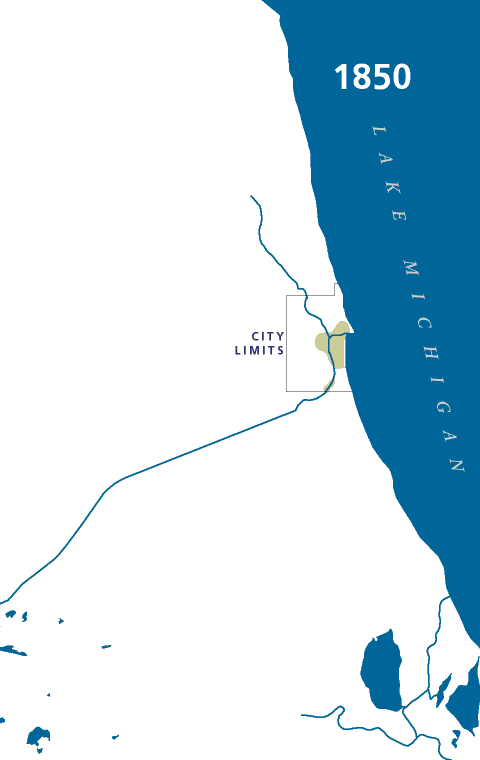
Chicago 1850population 29,963 |
The built-up area of the young city (green) extended only a third of the way to the city limits. The Illinois & Michigan Canal, opened in 1848, connected the city to Downstate Illinois and the Mississippi Valley. The first railroad reached the city the same year. |
Chicago 1860population 109,260 |
A dozen railroad lines now reached the city, and settlement reached west and north of the Chicago River. The first horsecar line opened in 1859, along State Street from Randolph to Roosevelt. |
Chicago 1870population 298,977 |
City limits have been extended, and development extended in fingerlike patterns out along the half-dozen horsecar lines. The city became a manufacturing center as well as the center of Western agricultural trade. |
Chicago 1880population 503,185 |
Post-Fire resettlement led to development of outlying neighborhoods and the first commuter suburbs, which appear like beads strung along the radiating railroad lines. |
Chicago 1890population 1,099,850 |
The city's territory more than doubled as surrounding towns agreed to annexation in 1889. Other settled areas, such as Evanston, Oak Park, and Maywood, remained independent of the city. New cable car lines reached further out from the Loop than the old horsecars could. |
Chicago 1900population 1,698,575 |
The first elevated line opened in 1892 and was quickly followed by others reaching far out into the neighborhoods. Both the L lines and new electric streetcar lines spurred development in outlying areas. The new Sanitary and Ship Canal replaced the Illinois & Michigan Canal. |
Chicago 1910population 2,185,283 |
Extensions to the elevated lines reached into developing areas and even beyond the city limits. |
Chicago 1920population 2,701,705 |
The L was extended to Wilmette and Berwyn. The North Shore Channel was dug to provide fresh water to flush the stagnant North Branch of the Chicago River. |
Chicago 1930population 3,376,438 |
A decade of frantic growth resulted in thousands of new bungalows encircling the city. Elevated extensions to Dempster (Niles Center, now Skokie) and 22nd & Mannheim (Westchester) were expected to serve new developments, but the Depression ended the city's homebuilding boom. New landfill areas created more lakefront parkland, some of which was used for the 1933-34 Century of Progress Exposition. The Cal-Sag Channel opened, connecting Lake Calumet port facilities to the Sanitary & Ship Canal. |
Chicago 1940population 3,396,808 |
The Depression hit Chicago hard, ending the city's building boom. The city changed little from 1930. Lake Shore Drive became the city's first express highway. |
Chicago 1950population 3,620,962 |
The State Street subway opened in 1943. After the Chicago Transit Authority took over rapid transit operations in 1947, service to Niles Center was ended. A postwar building boom filled in the city and the first ring of suburbs with new houses, and increasing auto ownership meant the development of areas far from public transit lines. |
Chicago 1960population 3,550,404 |
CTA closed several rapid transit branch lines during the 1950s, including the Stockyards, Kenwood, Humboldt Park, and Normal Park lines. The Garfield Park line was cut back to Desplaines Avenue and relocated to the median of the new Congress (now Eisenhower) Expressway. New development was most pronounced in the Morton Grove, Skokie, Niles, and Des Plaines areas, areas served by the new Edens Expressway or near the new O'Hare International Airport. The full tollway network and Calumet Skyway opened in 1958. |
Chicago 1970population 3,369,359 |
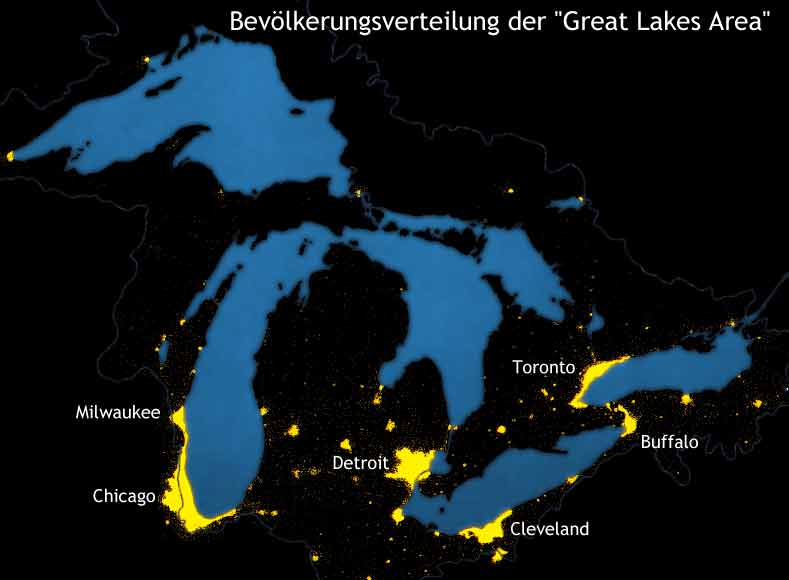
The expressway network (shown in rose) radiating from the Loop was finished. Skokie Swift service brought rapid transit back to Skokie in 1964, and two new lines were constructed in expressway medians: the extension to Jefferson Park and the Dan Ryan line to 95th Street. New port facilities at Lake Calumet followed completion of the St. Lawrence Seaway in 1959. |
Chicago 1980population 3,005,072 |
Suburban growth in the early 1970s spread to Schaumburg and Oak Brook, but then development slowed as a nationwide recession and declines in Midwest manufacturing hit Chicago. CTA suffered from a series of financial crises and service cutbacks. The planned Crosstown Expressway was cancelled as public attention turned to energy and environmental concerns. |
Chicago 1990population 2,783,726 |
Rapid transit service reached O'Hare, and money from the cancelled Crosstown Expressway paid for a new line to Midway Airport (opened 1993). A building boom filled the Loop with new office towers, and former industrial areas near the Loop were redeveloped with apartments and townhouses. |
Chicago 2000population 2,896,016 |
|
Notes:Delineations of built-up areas and water features were based on U.S. Geological Survey topographic maps, editions of 1899, 1929, 1953, 1962, 1973, 1980, and 1991. Other sources included maps in One Hundred Years of Land Values in Chicago, by Homer Hoyt (University of Chicago Press, 1933, and the 1939 survey published in 1942 by the City of Chicago as Residential Chicago: Volume I of the Chicago Land Use Survey. Areas shown for 1870, 1880, 1890, 1910, and 1920 have been interpolated from various sources. City limits compiled from City of Chicago annexation maps. Rapid transit lines compiled from CTA records. Expressways compiled from Cook County Highway Department publications. 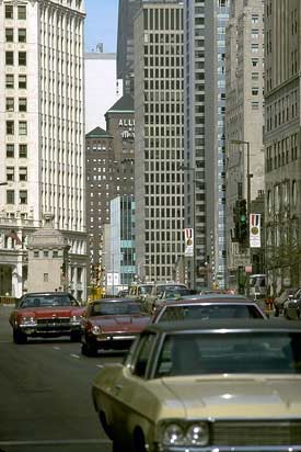 |
 |
 |
|
Quellen: |
Quellen und weiterführende Links im Netz: |